
Principles, Scenarios and Suitability
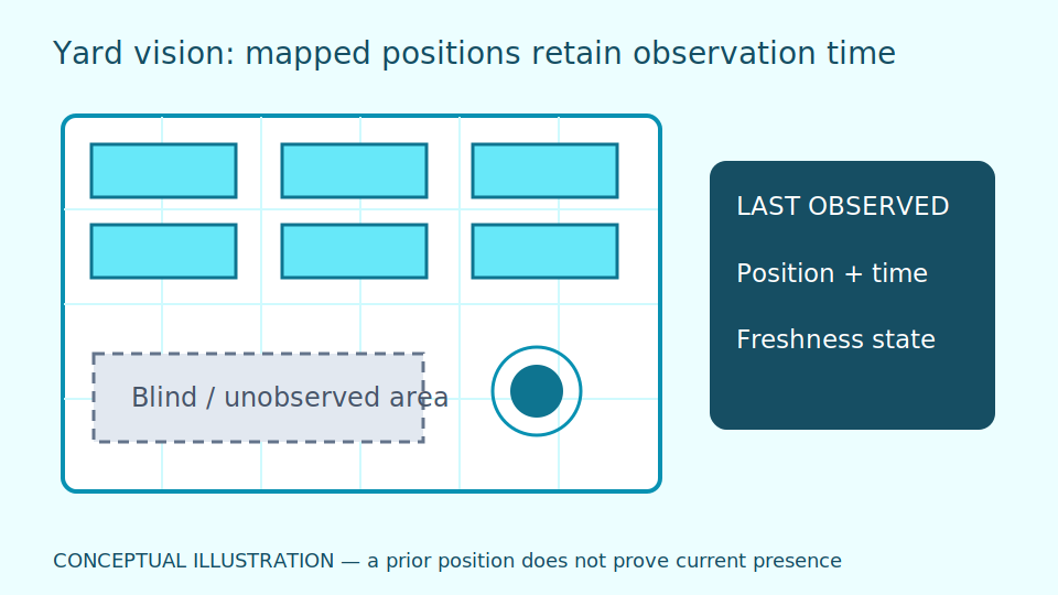
Yard vision locates objects on a map for search and planning. Distinguish the last observed position from a currently confirmed position. Disappearance behind containers or in blind spots must not be treated as evidence that an object has left the yard.
A yard map resembles a position log with update times. If a container was seen in the morning and the camera then became obscured, that is its last position, not proof it remains there in the afternoon. Tracking links objects between images; a trajectory is the path observed over time. Use information for search and coordination, not map images to certify clear space for machinery.
An ID switch exchanges tracking identifiers between similar objects, particularly stacked containers or across cameras. More cameras reduce some blind spots but add calibration and object-matching work. Include uncertainty and reconciliation with staff-confirmed movement records. A tracking identifier is not automatically a container code. Predicted lines through blind spots must not look like measured observations.
Scroll the diagram horizontally to inspect all details.
Illustrative Design Scenario
Illustrative design scenario: display containers with last-seen times and uncertainty after a forklift passes. Staff inspect uncovered locations and update records rather than treating a model-predicted trajectory as actual evidence.
Suppose a site record reports a move while the latest camera view still shows the old position. Display the conflict and each source's time. Later receipt must not override a later event without comparing event times. Arrange approved on-site verification or await another view; do not direct machinery to an unconfirmed location.
Options include adding cameras at frequently searched locations or combining movement records with images. Cameras improve coverage but still face occlusion; records require quality and delay assessment. Test identity switches using historical data and simulations, not by bringing people or vehicles close together. Keep yard traffic measures primary.
Inputs and Prerequisites
Use yard maps, camera coordinates, blind-spot boundaries, object lists and movement events. Prepare several weather conditions with timestamped ground truth from site surveys.
Ground truth is human-confirmed information at a specified time, not a model prediction. Keep container codes distinct from tracking identifiers. Record map revisions when slots or camera locations change.
Results should show last position, time, observing source and confirmed or uncertain status, with areas outside camera coverage. Limit personal data and vehicle movements to yard purposes rather than unnecessarily profiling drivers.
Trial and Integration Workflow
- 1Calibrate camera locations to the map and mark areas without visibility.
- 2Track objects with confidence information and handle identifier changes.
- 3Reconcile mapped positions with site records and refer conflicts for human review.
Evaluation and Acceptance Criteria
Measure position correctness, stale duration and ID switches by area, including vehicle occlusion and rain. Assess the time needed to resolve conflicts and the uncovered proportion of the yard rather than relying on one tracking score.
Stale means older than the task permits. Verify display status changes when data stops even if the map point remains. Test similar objects and cross-camera moves to expose association errors that detection scores may hide.
Staff should trace conflicts from the map to images and movement records. Check retrospective corrections and total object counts. Finding positions in examples with entirely clear views is insufficient for acceptance.
Scroll the diagram horizontally to inspect all details.
Failure Cases and Limitations
Stacked containers and different views may confuse object identity. Estimated positions do not establish clear space for machinery movement. Yard information is not collision protection; retain traffic measures and on-site verification.
Rain, night lighting and yard rearrangement may change results. Review coordinates and reference images. Successful network connectivity does not establish visibility everywhere or freshness of every position.
Future automated search or planning needs specific evidence, not claims of existing yard control or guaranteed safe space. Image positions cannot establish operator wrongdoing without human review.
Practical Checklist
- Does every last-observed position show its data age?
- Are blind-spot boundaries visible to the user?
- Is there a reconciliation method for object-ID changes?